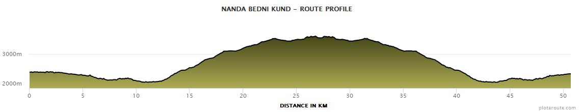
Elevation Profile
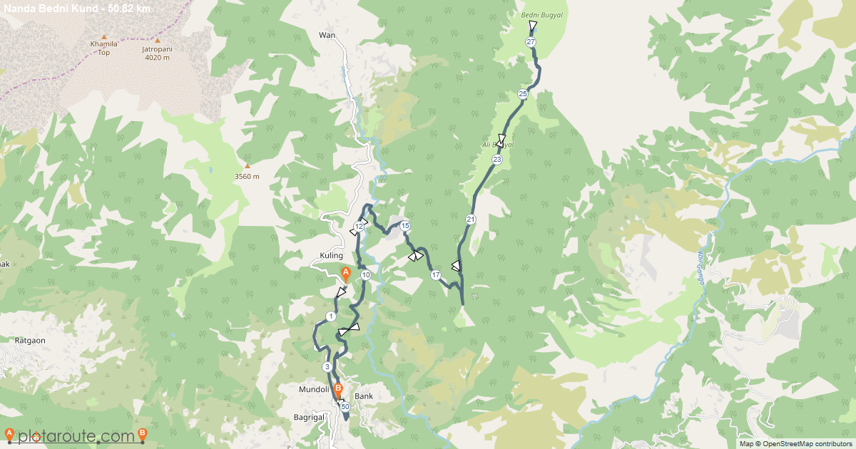
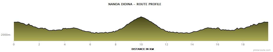
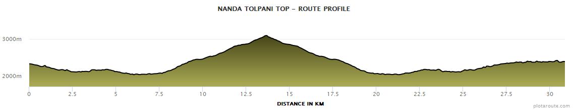
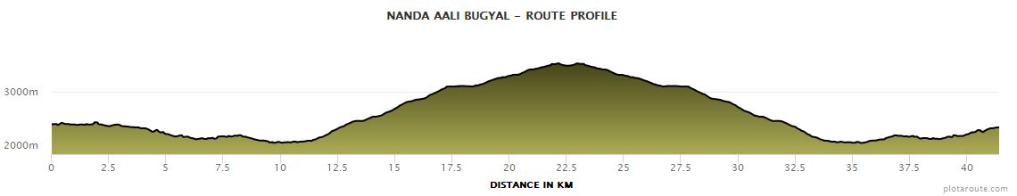
The courses involve significant elevation gain as runners move from the village of Lohajung toward the alpine meadows and high altitude ridges above 3000 meters.
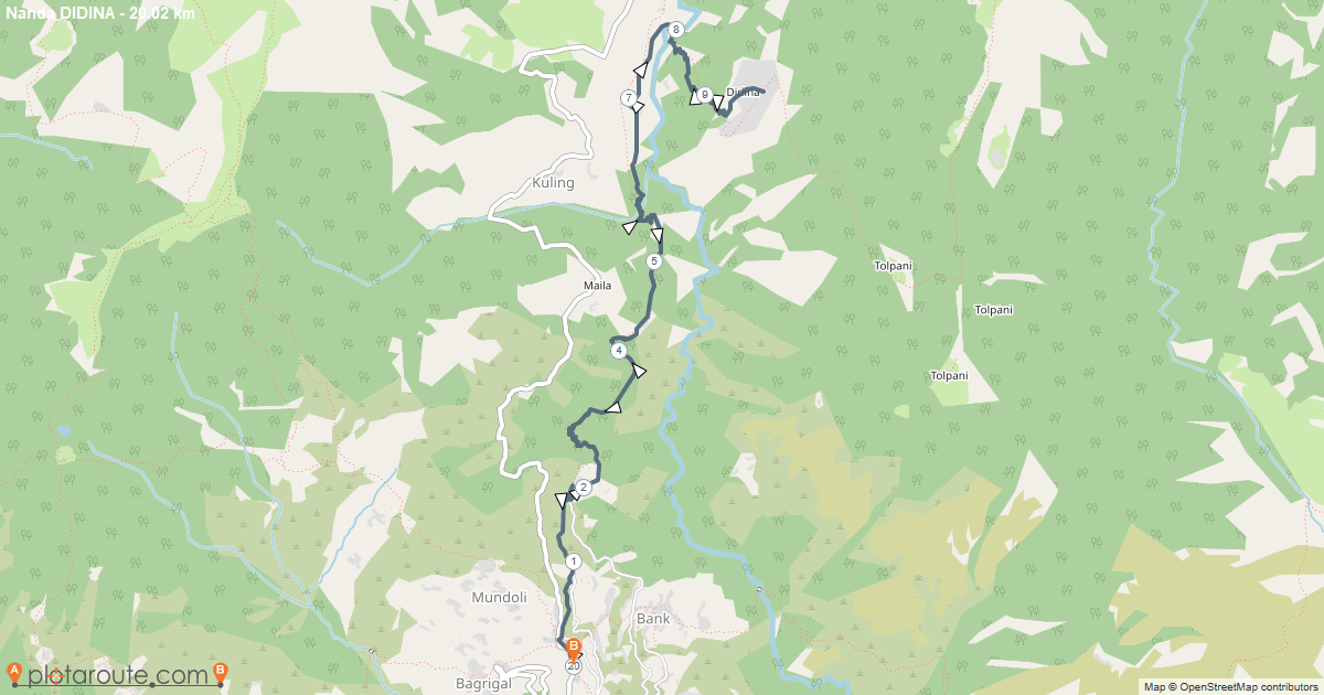
Nanda Didina
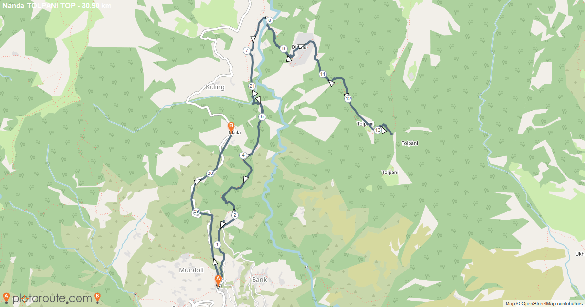
Nanda Tolpani Top
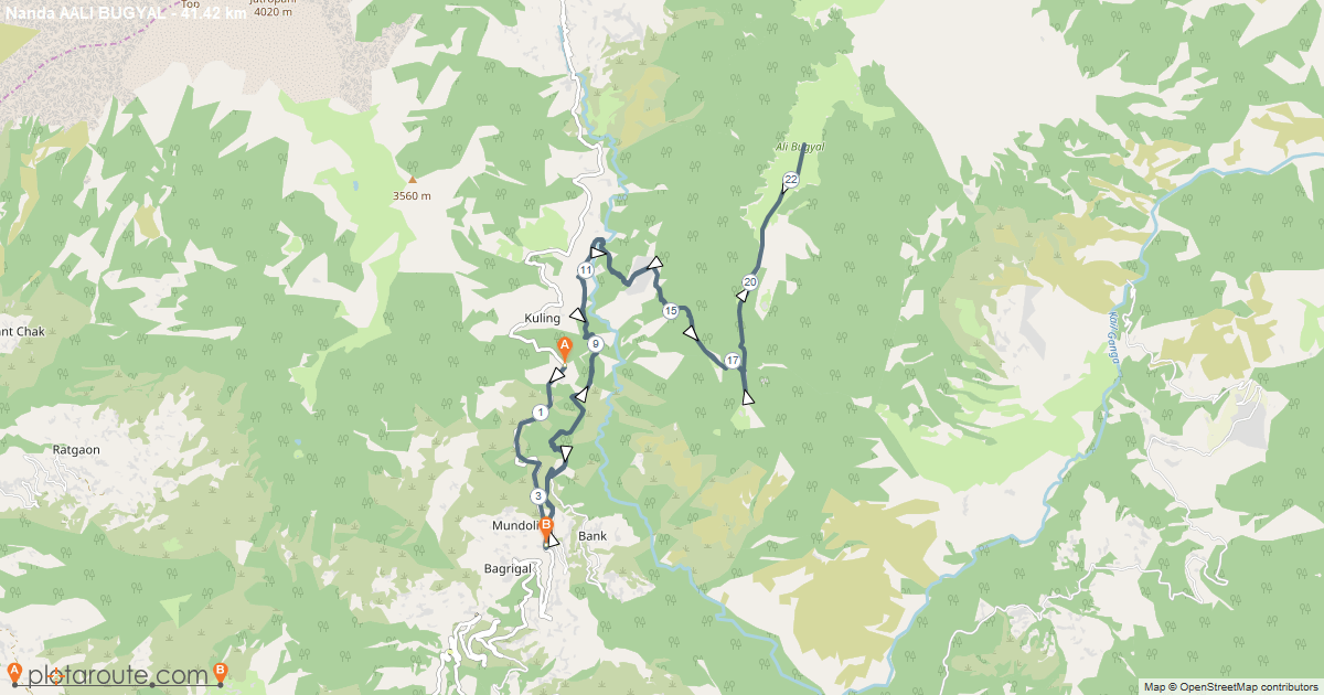
Nanda Aali Bugyal Top
Nanda Bedni Kund